UK Weather Forecast: ‘Snow Bomb’ Set to Deliver Heavy Falls with Potential One-Inch-Per-Hour Showers
Meteorologists warn of a significant wintry blast in early January as cold air and snow showers could lead to rapid accumulations across the UK
The United Kingdom is bracing for a significant wintry weather event in early January, with forecasts suggesting a so-called ‘snow bomb’ could bring heavy snow and wintry hazards to much of the country.
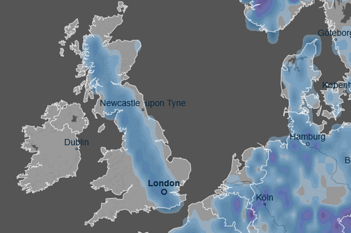
Weather models and long-range forecasts indicate that cold Arctic air will dominate the UK into the first week of January, raising the likelihood of widespread snow showers and rapid snowfall in some areas.
Forecasters have warned that under favourable conditions, snow could accumulate at rates approaching around one inch per hour in parts of Scotland and northern England, particularly where cold air interacts with moisture from the adjacent seas.
Met Office long-range guidance and independent forecasters project that the snow event will build from around the fourth of January, bringing notable accumulations in the Highlands and other northern and upland regions as Arctic air remains entrenched.
Cities including Glasgow and Edinburgh could see extended periods of snow, while central and southern Scotland might receive several centimetres of snow over several days.
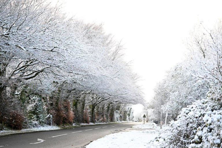
Temperatures are expected to remain below average for the period through to about the ninth of January, with widespread frost and icy conditions accompanying heavier snowfall.
Although the highest impacts are anticipated in Scotland, the forecast suggests that wintry showers could extend southwards into northern England, Wales and potentially as far as the Midlands and southern England during transient weather shifts.
Such patterns would reflect cold, unstable air crossing relatively warmer land and sea surfaces, creating frequent but locally intense snow bursts.
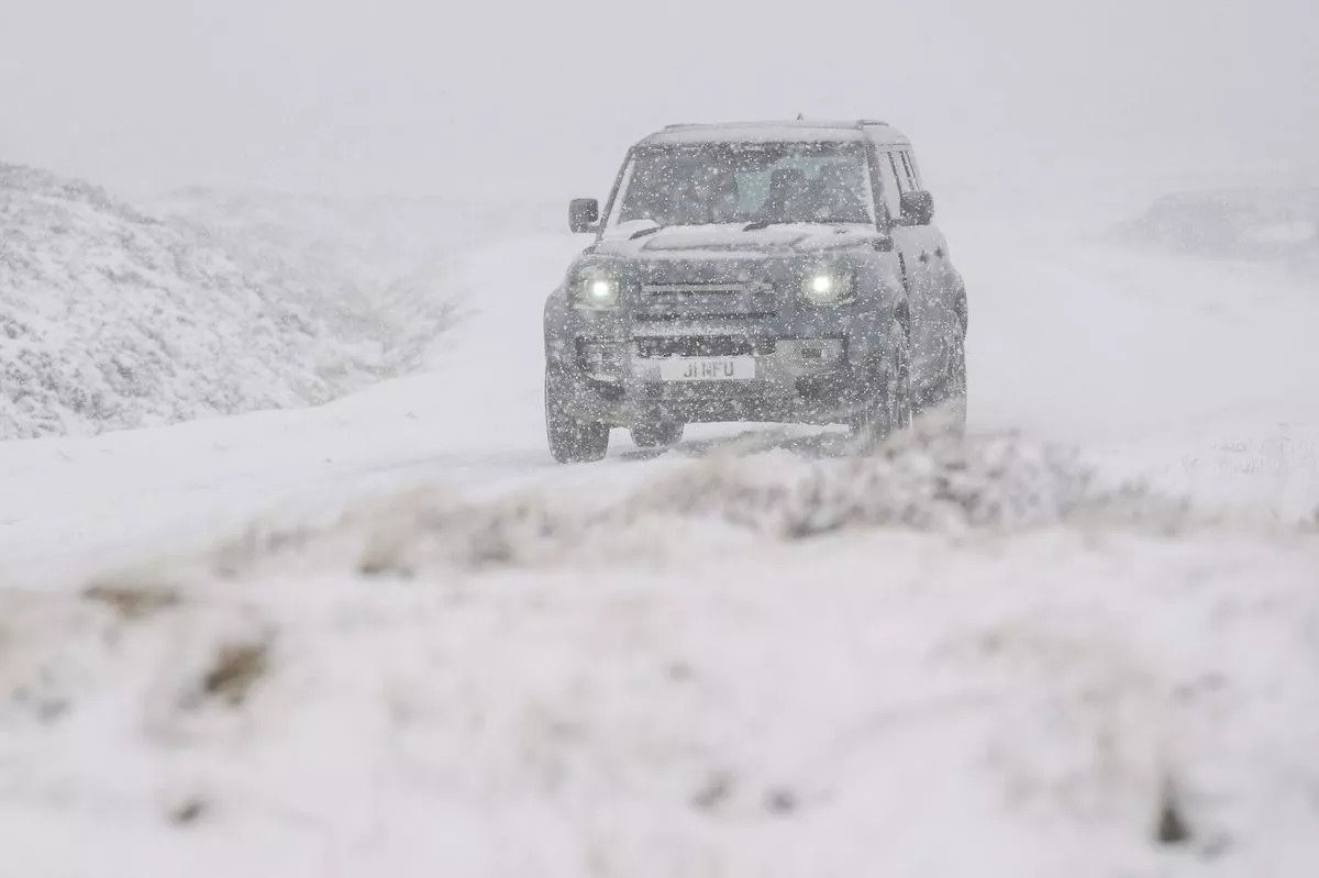
Drivers are being advised to prepare for rapidly changing conditions on roads, with potential travel delays and hazardous surfaces where snow settles quickly.
Forecasters emphasise that while exact snow amounts will vary regionally and precise timing remains subject to change as the event draws closer, the combination of below-average temperatures, Arctic airflow and periodic moisture influxes make a notable snow event more likely than earlier forecasts indicated.
Residents planning travel in the early New Year are encouraged to monitor the latest forecast updates and heed any weather warnings issued by the Met Office and local authorities, as conditions could change rapidly as the Arctic blast progresses across the UK.
Weather models and long-range forecasts indicate that cold Arctic air will dominate the UK into the first week of January, raising the likelihood of widespread snow showers and rapid snowfall in some areas.
Forecasters have warned that under favourable conditions, snow could accumulate at rates approaching around one inch per hour in parts of Scotland and northern England, particularly where cold air interacts with moisture from the adjacent seas.
Met Office long-range guidance and independent forecasters project that the snow event will build from around the fourth of January, bringing notable accumulations in the Highlands and other northern and upland regions as Arctic air remains entrenched.
Cities including Glasgow and Edinburgh could see extended periods of snow, while central and southern Scotland might receive several centimetres of snow over several days.
Temperatures are expected to remain below average for the period through to about the ninth of January, with widespread frost and icy conditions accompanying heavier snowfall.
Although the highest impacts are anticipated in Scotland, the forecast suggests that wintry showers could extend southwards into northern England, Wales and potentially as far as the Midlands and southern England during transient weather shifts.
Such patterns would reflect cold, unstable air crossing relatively warmer land and sea surfaces, creating frequent but locally intense snow bursts.
Drivers are being advised to prepare for rapidly changing conditions on roads, with potential travel delays and hazardous surfaces where snow settles quickly.
Forecasters emphasise that while exact snow amounts will vary regionally and precise timing remains subject to change as the event draws closer, the combination of below-average temperatures, Arctic airflow and periodic moisture influxes make a notable snow event more likely than earlier forecasts indicated.
Residents planning travel in the early New Year are encouraged to monitor the latest forecast updates and heed any weather warnings issued by the Met Office and local authorities, as conditions could change rapidly as the Arctic blast progresses across the UK.