Heavy snow, ice and freezing temperatures to return as arctic blast hits UK
It comes after freezing conditions recently gave way to unseasonably balmy weather for December.
The UK has seen a wild swing in temperatures over the last week with an ‘extraordinary’ rise of almost 20 degrees celsius in just a few days.
But from Boxing Day, a wave of arctic air will bring ‘colder conditions’ amid potentially more snow and frost.
James Madden, forecaster for Exacta Weather, told GB News: ‘The rest of December and January are showing signs of frequent spells of cold wintry weather with below-average temperatures and numerous wintry blasts.
‘We could now be looking at a lengthy cold period setting in for a number of weeks and the potential for some of the coldest and snowiest weather since December 2010.’
The Met Office’s long-range forecast echoes the comments made by Mr Madden.
From Boxing Day onwards, the UK should expect ‘uncertainties’ and ‘colder conditions’.
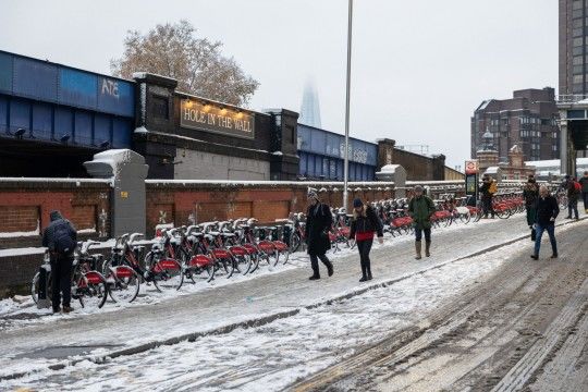 Snowfall across much of England recently gave way to slush and ice
‘Elsewhere, some sunshine, but an area of cloud and rain, with a small chance of snow on its northern edge may return from the south for a time.
‘For the following few days, probably a fairly windy and changeable period of weather, with rain, and some snow at times, interspersed with colder, brighter spells.
‘Around the turn of the year, uncertainties in the forecast increase, but a ridge of high pressure may bring a quieter interlude for many with more widely colder conditions, overnight frost and crisp, sunny days.
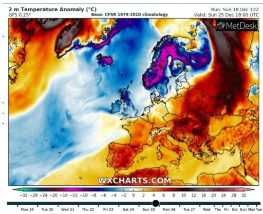 A blast of arctic air could bring further snow to much of the country
‘Some wintry showers are also possible, especially in coastal areas.’
The cold snap will come after December 25 – meaning odds of a White Christmas are dashed for many.
Experts are now forecasting that the date will most likely be mild with a risk of rain or showers in places for the south, especially the far south.
Any cold air and wintry conditions will most likely be confined to the north of the UK, they add, but caution that their predictions could change as Sunday is still five days away.
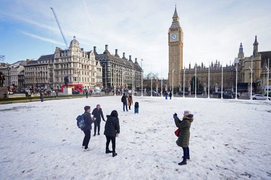 But forecasters have ruled out a White Christmas for much of the UK
Met Office deputy chief meteorologist, Dan Harris, said of the north-south split: ‘There are large uncertainties concerning where the boundary between these two air masses will eventually end up, especially as we head into the Christmas weekend.
‘Confidence in the forecast is unlikely to increase until mid-week at the earliest and a range of outcomes are still possible.’