LONDON DAILY ARCHIVE
Antarctica mysteries to be mapped by robot plane
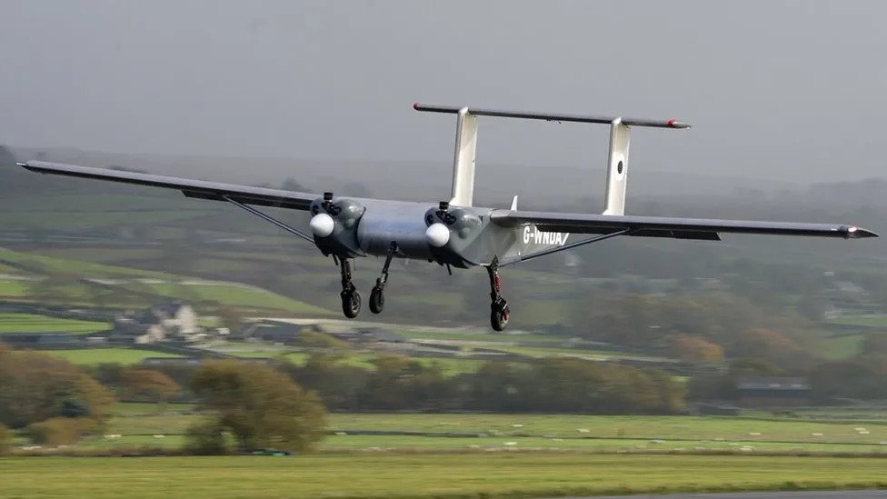
A team of experts has arrived in Antarctica to field-test a drone designed to help predict climate change impacts by mapping previously inaccessible regions of the continent.
03 February 2024 · 14:56 UTC
The drone's inaugural mission is to scan beneath the ice sheet's surface to inform projections on ice melt rate and potential contributions to global sea-level rise.
Scientists, constrained by current technological limitations and the hostilities of Antarctic weather, are turning to this drone, developed by the British Antarctic Survey and Windracers, as a safer and more efficient alternative to crewed flights.
Capable of transporting 100kg of cargo over 1,000km, the drone is equipped with radar and cameras, and can be remotely operated through a computer.
In the future, operations may even be conducted from the UK. With substantial fuel efficiency improvements, the drone reduces the environmental toll of research operations.
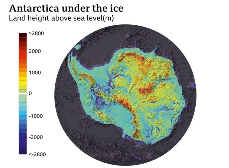
Gathered data will be analyzed at the British Antarctic Survey in Cambridge, aiding in the enhancement of the BEDMAP2 model – an intricate representation of the Antarctic landscape beneath its ice.
With many areas still uncharted, this work is critical for closing gaps in our understanding of the region's topography, which influences ice melt rates.
The drone's first target for radar mapping is the Fuchs Piedmont ice sheet. By capturing reflections of radio waves from the ground beneath the ice, scientists can delineate the landscape, increasing the accuracy of sea-level rise predictions.
The upcoming weeks will see the drone's first flights, with additional surveys planned to investigate marine life and environmentally sensitive regions.